Saturday, October 29, 2011

Bakerloo Line (London Underground)

The Bakerloo Line of the London Underground runs in a more or less straight line northwest-to-southeast across the city, serving 25 stations over 23.2 kilometres. These twenty-five stops are depicted in order, from first to last, starting in the northwest and going toward the southeast. I have taken a screenshot from Google Maps Street View of all 25 of these stations and included them here. In each case, clicking on them will allow the opportunity to make them larger and to navigate between them.

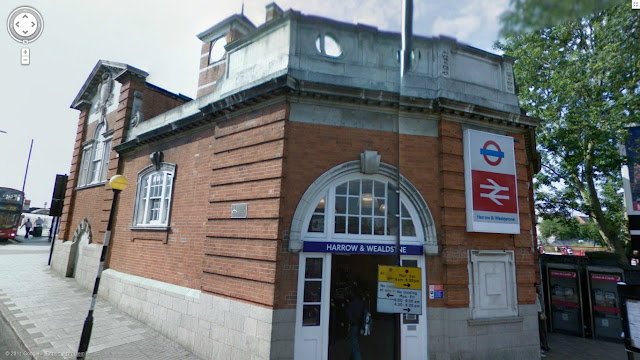
HARROW & WEALDSTONE

Harrow and Wealdstone station on the Bakerloo line of the London Underground

KENTON

Kenton station on the Bakerloo line of the London Underground

SOUTH KENTON

South Kenton station on the Bakerloo line of the London Underground

NORTH WEMBLEY

North Wembley station on the Bakerloo line of the London Underground

WEMBLEY CENTRAL

Wembley Central station on the Bakerloo line of the London Underground

STONEBRIDGE PARK

Stonebridge Park station on the Bakerloo line of the London Underground

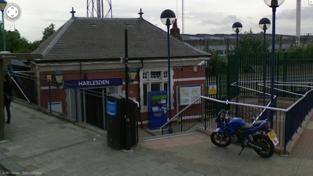
HARLESDEN

Harlesden station on the Bakerloo line of the London Underground

WILLESDEN JUNCTION

Willesden Junction station on the Bakerloo line of the London Underground

KENSAL GREEN

Kensal Green station on the Bakerloo line of the London Underground

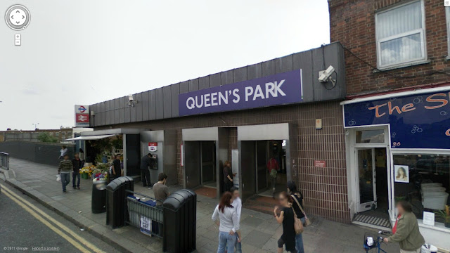
QUEEN'S PARK

Queen's Park station on the Bakerloo line of the London Underground

KILBURN PARK

Kilburn Park station on the Bakerloo line of the London Underground

MAIDA VALE

Maida Vale station on the Bakerloo line of the London Underground

WARWICK AVENUE

Warwick Avenue station on the Bakerloo line of the London Underground

PADDINGTON

Paddington station on the Bakerloo line of the London Underground

EDGWARE

Edgware station on the Bakerloo line of the London Underground

MARYLEBONE

Marylebone station on the Bakerloo line of the London Underground

BAKER STREET

Baker Street station on the Bakerloo line of the London Underground

REGENT'S PARK

Regent's Park station on the Bakerloo line of the London Underground

OXFORD CIRCUS

Oxford Circus station on the Bakerloo line of the London Underground

PICCADILLY CIRCUS

Piccadilly Circus station on the Bakerloo line of the London Underground

CHARING CROSS

Charing Cross station on the Bakerloo line of the London Underground

EMBANKMENT

Embankment station on the Bakerloo line of the London Underground

WATERLOO

Waterloo station on the Bakerloo line of the London Underground

LAMBETH NORTH

Lambeth North station on the Bakerloo line of the London Underground

ELEPHANT & CASTLE

Lambeth North station on the Bakerloo line of the London Underground

Introduction

So I've found every station on the London Underground network which is visible on Google Maps and have taken a screenshot. Why? Well, I think it's mostly because it's a cool way to 'explore' the city, and in London's case not only is there a very particular design aesthetic to most Tube stations which is interesting when applied to all kind of different buildings but several of the stations, particularly older ones in the centre of the city, are gorgeous.

I haven't decided yet whether I'll include the metro systems of other countries on this particular blog or not. But perhaps other cities in the UK, and probably other forms of transit in London too with time (i.e. Overground, Docklands Light Railway, etc.)